
Summers in New England are short, but oh-so-sweet. Any native New Englander knows you’ve got to take advantage of the sunshine and high temps while they last because once the first frost hits, it’s parkas, shovels, and icy winds lashing your face for at least four months. I have been making the most of my Maine Summer and spending lots of time in the great outdoors; swimming in lakes, bumming on beaches, and hiking some of the best trails in Southern Maine.
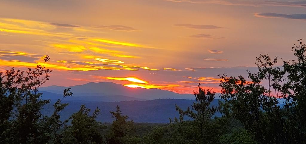
Autumn is upon us now but believe me you haven’t missed out. Fall is maybe the BEST time of all to hike in New England. The lack of bugs makes trekking a lot more enjoyable, the lack of humidity makes a less sweaty experience, and the changing leaves make the vistas that much more striking.
Here are four of the best hikes in Southern Maine that I’ve found. And while we are ramping up for Fall foliage here in New England, it is the perfect time to try one of them out for yourself!
Best Hikes in Southern Maine

Abbot Mountain, Shapleigh
Moderate, 2. 6 miles, out and back
Summit: 1063 ft, 324 m
Abbott Mountain is short but packs a good punch. A good portion of the 2.6 miles is up steep sand and rock face. The other half is rocky, sandy wooded trail with rolling inclines and declines. It’s a great little workout and the views are spectacular. (More so from the overlook before the summit, oddly.)
Getting to the right place can be a bit confusing, so here is the lowdown: Park on the corner of Owl’s Nest Rd & Pitts Road. Just pull off to the side by the telephone pole and make sure you’re not blocking the trail straight ahead. You will notice on said telephone pole two signs, one pointing to Sugarloaf Mountain, which will be in the direction you had already been driving. And one pointing to Abbot Mountain trail, which will be perpendicular and will look like another paved road. This is where you want to go. It looks like a private road, but any sign you come across is indicating this to drivers of vehicles, not foot traffic. This is the correct way. Keep walking straight on Pitts Road, past a few houses, until you come to the trail entrance. You will come to two separate forks in the road. Take LEFT both times, and you will find a steep boulder & sand mountaintop awaiting you.
Things to note:
The beginning portion of the trail can be buggy, so I’d advise using whatever repellant method you prefer. Also, this trail is shared with ATVs so be on the lookout—or listen-out!—for motorized vehicles. There should not be any once you get to the top portion with sand and rock, but one can never say for sure.
Directions & more via Alltrails: https://www.alltrails.com/explore/trail/us/maine/abbott-mountain–2


“Going to the mountains is like going home.”
-John Muir
For more awesome New England hikes, check out some of my other posts:

Sawyer Mountain, Limerick
Moderate, 3.9 miles, Loop/out and back
Summit: 1213 ft, 369.7 m
Another trail hiked over Labor Day weekend that I fell in love with! Some of the reviews mention that the view isn’t that great from the top, and I’ll give it to them- it is partially obstructed by trees. But you can see over the treetops to a pretty beautiful view. It was especially beautiful during the golden hour, around 5:30-6pm when we were up there. It may not be the BEST view in Southern Maine, but the trail itself was so nice that I am calling this trek an essential Southern Maine hike no matter what those haters say.
The trail changed from rocky to soft, pine-needle and dirt, giving your knees a break and your eyes a chance to delight in all new scenery, about halfway up. The distance and incline were perfect for getting that workout in but not taking all day or feeling completely exhausted afterward. It was everything I love in an afternoon hike. The trail markers, rather than paint splotches, were little carved wooden turtles, which was very cute and made me like the trail even more.
Things to note:
The reviews on Alltrails mention having difficulty finding the way. But I’m not sure how that was. It seemed straightforward to us, following the turtle trail.
There is a loop toward the top that hits the summit and other peaks. We did the summit trail as an out-and-back, so I cannot attest to the rest of the upper loop. (This also may have made our hike shorter, though I don’t know by how much.)
Directions & more on Alltrails: https://www.alltrails.com/explore/trail/us/maine/sawyer-mountain-trail


Mount Cutler,
Moderate, 3.7 mile loop, 2.4 mile out and back
There are a bunch of different trails on Mount Cutler, so you can do this as an out-and-back or a loop. (There are more than two trails, all of which are marked with different colors, so you can kind of make your loop however you want it.)
Summit: 1,234 ft., 376 m
Get ready to scale some boulders! Something about climbing over big rocks makes me feel at once like a real live wilderness adventurer and a small child again. There is a section of Mount Cutler that contains steep boulder and rock face climbing that might make you sweat if you are afraid of heights. (Or have less than excellent balance!) The views from the top are STUNNING. Green rolling hills and the Saco River snaking through. Photo ops abound, and there are plenty of places to sit and have a snack. You worked hard, after all!
Another thing I really enjoyed about this trail was that the landscape and terrain changed a few times. (Have I ever mentioned that I love variety?) Starting in your typical southern Maine wooded trail, you climb quickly, and soon arrive at the boulder/mountain goat section I mentioned before. At the end of this rocky stretch, you’ve gained some serious elevation, and beautiful views greet you from the overlook. We rested here for a few minutes and I peeked around at the ways the trail split up. One of the routes, the one we were not taking, looked completely different. Darker, quieter, soft dirt and needles on the ground, and the trees were white birch. All lined up.
On the way down, after reaching the top, we went for the loop and descended through an unfamiliar trail. We walked down exposed, sundrenched rock face, then suddenly found ourselves in a labyrinth of tightly packed, skinny trees. The trail carved through them was barely wider than each of us, giving the intimate feeling that they—the trees—were leaning in close. Toward the end of the hike I was stung by two bees which sucked because they gave no warning, only pain. I believe this was toward the end of the yellow trail. I guess the multiple wounds make me more of a badass this Summer, right?
We began and ended the trail on railroad tracks, so if you see them then you’re likely in the right place.
Things to note:
Watch for bees flying around near the ground.
Alltrails gives two hiking options, one is the “short option” and one is the “Loop”. There are two different parking areas. However, they’re not that far from one another. We started on the short trail, but instead of turning and heading back, made the loop. This just meant we had to walk a bit (maybe .3 miles) over railroad tracks to the car.
There is a swimming spot just a few minutes’ drive from the little parking lot, if you’re up for a dip after.
Directions & more info on Alltrails: https://www.alltrails.com/explore/trail/us/maine/mount-cutler-trail
Short Option: https://www.alltrails.com/explore/trail/us/maine/mount-cutler-trail-short-option


Douglas Mountain , Sebago
Moderate, 1.8 miles, Loop
Summit: 1368 ft (although it is only a gain of 475 ft from the parking lot.), 417 m
I just did a family hike at this mountain and it was so great! By no means a full day trek, the hike only took us about an hour and a half and we spent some time hanging out at the tower up top.
Douglas Mountain is the highest elevation in Southern Maine, which makes it an essential Southern Maine hike. It also indicates just how stumpy the mountains here are. Don’t get it twisted though, they may be lacking in elevation but not in views. Plus, having SO many mountains and trails in close proximity to one another means you can have your full day or multi-day hiking experience, but from all different peaks! There is a sign indicating a parking lot off Douglas Mountain Rd. Plenty of spots were available the day we went, and the lot has 20 or so parking spaces. There is a suggested donation of $3 which works on the honor system. If you like maintained trails, or just appreciate a day in the woods, I recommend forking over the small sum.
There are a couple different trails, although they all seem to take you in basically the same loop. We took Eagle Scout Trail to the Summit and then Ledge Trail to the bottom. At the Summit, there is a stone you can go in and up to the top. From there, you can see the range of the White Mountains of New Hampshire—mountains I am far more familiar with, inciting a sense of nostalgia-fueled warm and fuzzy. Continue panning to the right and see Maine mountains, and then all the way to the East where you can see Sebago Lake in all its glory, sprawling, huge, glistening silver. Proximity to Sebago was one of the reasons we chose to hike Douglas in the first place. Post-hike we hit one of the lake’s public beaches for a post-hike swim.
Things to note:
There were little to no bugs, but it being early September, I can’t say if this is true in hotter months. At the end of the trail, you’ll come back out to a paved road. You are not lost. Just continue heading down hill until you come to the right-hand turn for the parking lot. It will be just shortly after a brown house with a horse in the yard and a very cute black and white dog.
Directions & more info via Alltrails: https://www.alltrails.com/explore/trail/us/maine/douglas-mountain-loop-trail


And there you have it: Four essential hikes in Southern Maine. Each of these hikes will give you views, a solid workout, and some quality time in the nature. With Fall upon us, there is no better time to get out there and hike in New England. So, pack up your snacks, and your packs, and your Camelbacks and get moving! What are you waiting for—Winter?


Keep in mind...

hikes are always better